 |
|
|
|
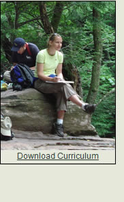
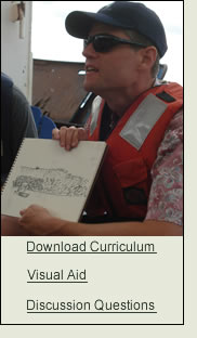
| River Summer curriculum 'mini lessons' have been designed by some of the participating faculty. Designed for the non specialist on a topic, these 'lessons' will bring field based learning into your curriculum and will facilitate the incorporation of interdisciplinary topics into your
teaching. Each 'mini lesson' has teaching tips, resources, step by
step activity descriptions and contact information for the project developer. We hope these assist you in getting out into the field to learn about the Hudson Valley. |
|
|
| |
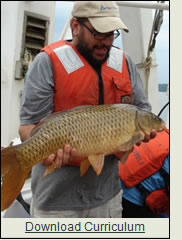 |
Biological Sciences: Fisheries Biology
Hudson River Fish Sampling
PROJECT DEVELOPER:
Brian H. Jensen, Ph.D., Physical and Biological Science, College of St. Rose
ABSTRACT:
Fisheries biology is a broad field with many important applications. It is used to monitor
the health of the ecosystem, manage an extremely important natural resource, and predict
future populations of fish. Although it is impossible to cover all, or even many aspects of
fisheries activity in such a brief period of time it is possible to cover some general
biology aspects that are essential to good fisheries biology. In this activity, students will
be introduced to; 1) an overview of fisheries biology; 2) basic sampling techniques that
are frequently employed in fisheries biology; 3) the difference between quantitative and
qualitative data and the usefulness of each in fisheries biology; 4) the use of a dichotomous key; 5) use of a beach (haul) seine and data collection. |
|
|
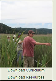 |
Biological Sciences,
Hudson River Marsh Ecology
Impact of a Nonnative and Invasive Plant Species on the Structure &
Function of Tidal Marshes
PROJECT DEVELOPER: Carol S. Rietsma, Ph.D., Biology Department, SUNY New
Paltz, 1 Hawk Drive, New Paltz, NY 12561
ABSTRACT: During the past century, a nonnative genotype of the grass Phragmites
australis has aggressively invaded and expanded in tidal marshes, displacing native species. This
project involves field sampling of Phragmites and native species in a marsh using a line transect
and quadrats. The number of stems of each species is counted within the quadrats and compared
by plotting either the number of stems or the percentage of total stems of each species along the
line transect. The differences in habitat created by Phragmites relative to other species will be
readily apparent in the field. |
|
|
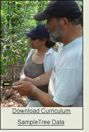 |
Biological Sciences, Hudson River Watershed Forest Ecology
Comparing Forest Communities in Close Proximity
PROJECT DEVELOPER: Tom Sarro, Ph.D., Biology Department, Mount Saint Mary College, 330 Powell Ave., Newburgh, New York, 12550
ABSTRACT: Forest communities in close proximity can vary considerably with respect to species composition. The composition of these communities is a factor of soil, light, moisture, aspect and other ecological factors. This project utilizes the Point-Center Quarter Method to analyze two closely situated forest communities. The communities to be compared can be located along an altitudinal gradient, north vs. south facing slopes, or areas with markedly different ecological habitats. Data collected will be entered into a spreadsheet and an Importance Value will be calculated based on how common the species is across the community (density), the total amount of area the species occupies (dominance), and the total number of the species in the community (frequency). Importance values are then plotted using both column and pie charts. This curriculum can be combined with River Summer Curriculum Module: Geographic Information Systems (GIS) CampusBlitz: An Introduction to the Use of GPS and GIS for Data Collection and Display. |
|
|
|
| |
|
 |
Humanities: Art & Literature
Seeing the Hudson Valley through the eyes of the 'Hudson River School'
PROJECT DEVELOPER:
Elizabeth Hutchinson, Barnard College
ABSTRACT: In the mid-nineteenth century, paintings of landscapes along the Hudson were widely celebrated as the first “American” school of art. These painters turned away from traditional academic subjects, which frequently referenced European culture and history, to focus on the beauty of their own environment. Painters and patrons alike turned their gaze toward the American landscape as an escape from increasingly industrialized and socially turbulent cities, as an outlet for their interest in natural history and as an inspiration for metaphysical contemplation.
Students in this unit will gain insight into these artists’ practices by creating their own representations of a natural environment according to the principles of Romanticism. In so doing, they will hone their own powers of observation and exercise judgment over the selection and depiction of what lies before them. This will not only help them understand what makes a picture "good," but will also help them understand that every representation is an interpretation, as it takes the overwhelmingly complex and diverse material of physical world and translates it according to principles and rules. |
|
|
 |
Humanities: Conservation History
The Historic Palisades Interstate Park Commission: A Collaboration Built on Differences
PROJECT DEVELOPER:
Margie Turrin, Education Coordinator, Lamont-Doherty Earth Observatory, 61 Route
9W, Palisades NY 10964
ABSTRACT:In 1900 the Palisades Interstate Park System (PIP) was born of a
collaboration of states and individuals, each with their own motivation to place the New
Jersey/New York waterfront lands into protected public ownership. Were they
Conservationists? Environmentalists? Social Reformists? Or just some of the first
NIMBYists? (not in my backyard)? The cast of characters involved in establishing and
extending the park system held a wide range of reasons for supporting the project, and yet
managed to work together to protect thousands of acres of forests and historic areas.
From this foundation has grown a park that today holds over 100,000 acres and eight
historic sites. In forming the 1st Interstate Park collaboration this group ‘broke ground’ at
every step from their methods of finance that included both public and private funds,
their ability to wrestle new parkland from successful companies and powerful
individuals, the critical role that women played in this collaborative venture, their
creation of lakes and campgrounds for both the state’s wealthiest and New York City’s
poorest, and their ability to turn the Great Depression into an opportunity to expand and
enhance their facilities. |
|
| |
|
|
| |
|
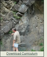 |
Natural Sciences: Geology
Geology of the Hudson Highlands Region
PROJECT DEVELOPER:
Steven H. Schimmrich,
SUNY Ulster County Community College,
Stone Ridge, New York 12484
ABSTRACT: The Hudson Valley of New York State has a complicated 1.3 billion year geologic
history represented by several geologic provinces located between New York City
and Albany. While there are a number of accessible areas where students can be
exposed to the rocks and structures geologists have used to unravel the complicated
history of the Valley, they are often separated by distances which make it impossible
to visit them all in one day. This module will therefore focus on the geology of one
selected area, the top of Bear Mountain in the Hudson Highlands, and relate this to
the larger picture of the Hudson Valley's geologic history. |
|
|
|
| |
|
 |
Social Science: The Indigenous Hudson
Interdisciplinary Perspectives on "Muh-hekun-ne-tuk" River Sites, or "A Tale of Three Middens"
PROJECT DEVELOPER: Robert Spiegelman, City University of New York
ABSTRACT: In 1960, author and educator C. Wright Mills launched a paradigm for conducting interdisciplinary study called “The Sociological Imagination”—the intersection of culture, biography and history. Today, the environment has become an essential ingredient in this mix. This Activity uses Mills' interdisciplinary approach to foster place-based education on the Hudson through exploring Shell Middens that provide a unique window on indigenous lifeways along the Muh-he-kun-ne-tuk
(Hudson) River - "the river that flows two ways." It uses the Shell Midden as a window into the land and development history of selected alongshore sites and trading networks, both during and since their habitation by indigenous peoples. Students will develop or enhance their interdisciplinary – biographical, cultural, historical and environmental – skills, habits and understandings, learning to view a site as a palimpsest, using multiple, overlapping, and synergizing analytic lenses. To do this will require a particular acquired sensitivity to the traces, absences and meanings of prior indigenous activity. |
|
|
 |
Social Sciences:
Urban Ecology & Economics
Re-development of a River Town:
New Urbanism, the Political Economy of the Hudson River Valley and a Walking Tour Case Study: an exercise in combining urban ecology, political economics, and environmental justice
PROJECT DEVELOPER: Marilyn Power, Professor of Economics, Sarah Lawrence College, Yonkers New York
ABSTRACT: This activity encourages students to examine the challenges and choices facing urban communities and their planners. Students will be introduced to social science concepts related to urban ecology. Once concepts have been introduced a concrete example will be presented through a walking tour of an urban area in which the natural and built environments intersect closely. The tour will highlight relations among the human 'actors' in the space, as they negotiate their different uses of the environment and political-economic concerns. Concepts of environmental justice, and the categories of the new urbanism movement, help structure the tour, drawing attention to aspects of the urban environment that might otherwise be rendered invisible. |
|
|
 |
Geographic Information Systems (GIS)
CampusBlitz: An Introduction to the Use of GPS and GIS for Data Collection and Display
PROJECT DEVELOPER: Daniel Farkas, PhD, Seidenberg School of Computer Science and Information Systems, Pace University
ABSTRACT:
By introducing Geographic Information Systems (GIS) into the university or high school curriculum, it becomes possible to enhance student understanding by providing a deeper exploration of the topics being studied. A bioblitz is a 24 hour inventory of all living things within a geographic area (e.g. park, forest, etc.). Scientists gather to identify and count all living organisms observed thus getting a snapshot index on diversity that can be compared geographically and chronologically. This activity, modeling the bioblitz, creates a count of living organisms identifiable by non-experts: mammals, amphibians and reptiles, birds, insects and trees. Depending on the subject expertise of the instructor, this can be expanded in more detail. Teams disperse across a field area (campus or park can be used) and spend 1-2 hours in the field taking an inventory of living things. The data collected is geo-referenced using GPS units and displayed in a GIS system. While activity, focused on introducing GIS, it is flexible enough to be adapted as an enhancement to a variety of content based curricula. |
|
| |
|
| |
| The River Summer program has been made possible through the generous support of The Andrew W. Mellon Foundation. This curriculum project has been funded in part by a grant from the New York State Environmental Protection Fund through the Hudson River Estuary Program of the New York State Department of Environmental Conservation. |
| |
|
| |
 |
|